
The Expanding Role of Drones in Environment Protection
Key Functions of Drones in Environmental Monitoring
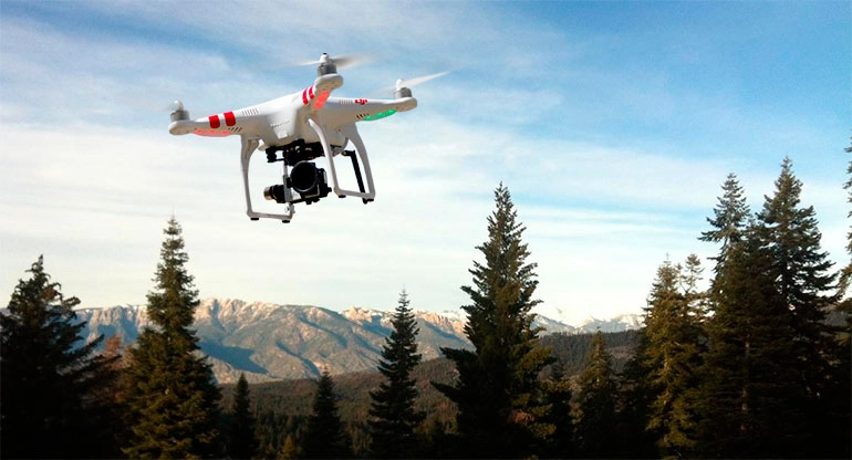
Drones, or unmanned aerial vehicles, are absolute legends for keeping the planet business! They’re out here mapping ecosystems, tracking animals’ moves, and checking plant vibes like total GOATs. Loaded with sick multispectral and thermal imaging sensors, drones snatch crazy-detailed data over huge, super sketchy lands. This lets eco-geeks and nature crews monitor changes with wild accuracy and mad frequency—like, brain-exploding precision, yo!
Plus, drones are sneaky ninjas for catching bad guys doing illegal stuff, like poaching or chopping trees. They fly low and hover all quiet, perfect for spying without freaking animals or tipping off the culprits. Total stealth energy, no cap!
Advantages of Drone-Based Surveillance Over Old-School Ways
Forget lame satellite shots or sweaty ground treks—drones are the real deal! They drop real-time data, crystal-clear pics, and can launch whenever you’re ready. Ground squads take forever and need a ton of people, while satellites get blocked by clouds or can’t swing back quick enough.
Drones zoom out on your say-so, following custom paths to grab steady data over time. This is clutch for tracking eco-trends or checking if conservation plans are slapping hard—way better than the old-school hustle!
Integration of High-Performance Batteries for Epic Missions
Drones are getting juiced with monster batteries that keep them soaring forever! Taixing Shengya Electronic Technology Co., Ltd. Customization Service drops lithium-ion soft pack cells with insane energy density, up to 340 watt-hours per kilogram, long cycle life of 800 to 1,000 cycles, and safe vibes like puncture resistance without going boom or catching fire.
Check the SY-12S-44.4V-22Ah battery: it packs at least 22 amp-hours capacity, a 10C discharge rate, and a 1,000-cycle life at full depth of discharge (Long Cycle Life 1,000 times (0.5C/0.5C; 100% DOD)). These let drones slay long missions in far-out zones without needing a recharge pit stop every second—pure game-changer vibes!
Air Quality and Pollution Monitoring with Drones
Real-Time Air Sampling and Emission Tracking
Drones with air quality sensors are zipping through cities and factories, snagging real-time air samples like detective bosses. They measure gross stuff like PM2.5, nitrogen oxides, sulfur dioxide, carbon dioxide, and volatile organic compounds, giving super-specific scoops on the air’s energy.
Unlike boring stationary monitors stuck in one spot, drones hit different heights and places in minutes, mapping pollution across whole cities or factory zones—dynamic as heck!
Identifying Pollution Sources Using Aerial Sensors
Drones with high-tech sensors are sniffing out pollution sources like pro hounds. Flying over factories, traffic jams, or landfills, they use infrared cameras or gas analyzers to spot emission hotspots. This helps eco-cops catch polluters red-handed with visual proof and lets factories find leaks or whoopsies in their systems—total sleuth swagger!
Enhancing Data Accuracy Through High-Endurance Drone Flights
Long flights are everything for grabbing steady data over massive areas or long times. Drone batteries from Taixing Shengya Electronic Technology Co., Ltd. crank endurance, letting drones cover huge zones without dropping their payload game. The SY-6S-21.6V-39Ah model rocks a 306 watt-hours per kilogram energy density and lightweight vibes, weighing only 2.75 kilograms, perfect for pinpoint eco-monitoring—no cap, just facts!
Forest and Agricultural Land Management Using Drones
Assessing Forest Health and Detecting Disease Outbreaks
Drones are forest MVPs, using multispectral pics to check chlorophyll levels—a big hint about plant health. Spotting disease outbreaks like bark beetle attacks early lets forest bosses act quick before trees get wrecked. Drones also measure canopy density, tree height spread, and biomass estimates—must-haves for carbon stock math. Total forest drip, yo!
Supporting Sustainable Agriculture through Aerial Imaging
Drones are flipping farming with high-res crop pics at different growth stages. Farmers spot nutrient shortages, pest attacks, or irrigation dramas early, saving mad resources while maxing yields. This smart approach lines up farming with environment protection goals—sustainable clout for days!
Soil Moisture and Crop Health Analysis via Drone Technology
Drones with thermal imaging sensors are geniuses at checking soil moisture across fields. This helps farmers nail irrigation plans, saving water while keeping crops popping. Normalized Difference Vegetation Index maps from drone imagery show crop vigor over time, helping plan fertilizer and harvest moves—pure farming fire!
Disaster Response and Environmental Risk Assessment
Rapid Damage Assessment After Natural Disasters
When disasters like earthquakes or hurricanes hit, drones swoop in to check damage without risking lives. They drop aerial visuals that help rescue crews prioritize based on bad-vibe zones. Drones use their fast flight speed, agility, and flexibility to survey disaster areas quick, sending real-time footage to command centers for smart planning—hero energy all day!
Monitoring Flood Zones, Landslides, and Coastal Erosion
Floods, landslides, and coastal erosion are wild cards that need constant eyes. Drones with LiDAR or photogrammetry tools make detailed topographic maps, spotting tiny terrain shifts for early warning systems. In coastal zones, drones track shoreline retreat from rising seas or storms, giving clutch data for long-term planning—lifesaver vibes!
Supporting Emergency Services with Real-Time Data
In sketchy situations like chemical spills or no-go terrains, drones give critical intel without putting peeps in danger. Unmanned aerial vehicles can handle long-term aerial monitoring on the ground, keeping costs low for real-time watching. This means faster responses and safer outcomes during crises—total clutch moves!
Future Trends in Drone Use for Environment Protection
AI Integration for Smarter Environmental Analysis
Artificial Intelligence is about to flip how drones handle eco-data. Machine learning algorithms scan drone pics to spot stuff like deforestation or algal blooms automatically—cutting manual work while cranking accuracy. AI-driven analytics also predict eco-changes based on past trends, making proactive conservation plans next-level—brainy as heck!
Swarm Technology and Autonomous Flight Paths for Large-Scale Monitoring
Swarm technology lets a squad of drones work together under one control system—perfect for big biodiversity surveys across huge areas. Autonomous flight paths level up efficiency with pre-programmed missions that adapt to real-time sensor inputs—pure autonomous flex for eco-intel!
Role of Battery Innovation in Shaping Next-Gen Environmental Drones
Battery glow-ups are key to unlocking drone superpowers for environment protection. High voltage 4.35V series products, like 20Ah, 25Ah, 27Ah, and 30Ah from Taixing Shengya Electronic Technology Co., Ltd., pack crazy power per weight, with high-energy density of 257 watt-hours per kilogram, letting drones carry heavy gear like LiDAR without tanking flight time. As safer solid-state lithium-ion cells drop, next-gen drones will slay eco-missions—future vibes on lock!
Frequently Asked Questions
- How do drones help environment protection?
Drones slaywith real-time monitoring of forests, air quality, pollution, disaster response, and sustainable farming, all powered by sick imaging tech and AI analytics—total eco-warriors! - Why is drone surveillance better than old methods?
Drones drop higher resolution imaging, cheapercosts, and flexible deployment compared to satellites or ground crews, giving faster scoops on eco-changes or violations—no contest! - Can drones monitor air pollution accurately?
Heck yeah! With gas analyzers and particulate sensors, drones snatch air samples right above pollution sources, giving pinpointreadings that smoke fixed stations—accuracy on fleek! - How does battery performance affect drone missions?
Longer-lasting batteries let drones cover massiveareas without constant recharges, key for remote habitats or emergency ops needing non-stop eyes—endurance for days! - Are there customizable solutions for environment protection needs?
Yup! Taixing Shengya Electronic Technology Co., Ltd. hooks up customizable battery packs tailored for drone missions, with configs like plug type or line position for eco-specificvibes—mad flexible!
Wanna own the drone game for environment protection? Hit Taixing Shengya Electronic Technology Co., Ltd. for banger battery solutions that keep drones soaring for eco-missions!


