The Role of Drones in Modern Geological Surveys
Benefits of Drones
Drones reshape geological research. They boost efficiency. They enhance accuracy. They reach remote areas safely. Hazardous sites pose less risk. High-resolution cameras capture detailed images. Advanced sensors gather precise data. This covers varied terrains. Drones cut survey time. They lower costs. Researchers focus on analysis. Logistics take less effort. Drones adapt easily. They map terrains. They monitor changes. They explore minerals.
Key Drone Features
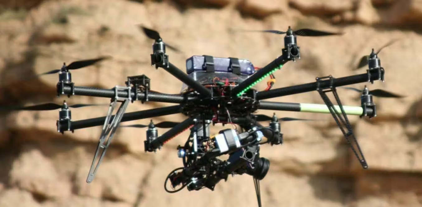
Geological drones stand out. They feature sharp imaging. Their designs are light yet tough. They handle harsh conditions. Long-endurance batteries extend flights. This suits vast regions. LiDAR integration adds value. It maps topography accurately. Photogrammetry creates 3D models. These tools enhance data collection. They make drones essential for fieldwork.
Drone Application in Geological Mapping
Topographic Mapping Precision
Drones excel in mapping. Traditional methods are slow. They risk errors. Environmental factors disrupt them. Drones offer a top-down view. They capture clear images. These stitch into detailed maps. Results are accurate. They come faster than old ways. This streamlines survey work.
Tracking Geological Changes
Geological shifts matter. Erosion alters landscapes. Landslides threaten safety. Tectonic moves impact regions. Drones monitor these changes. They conduct regular flyovers. Data from different times shows trends. Researchers spot patterns. They predict future events. This aids disaster planning. It supports conservation efforts.
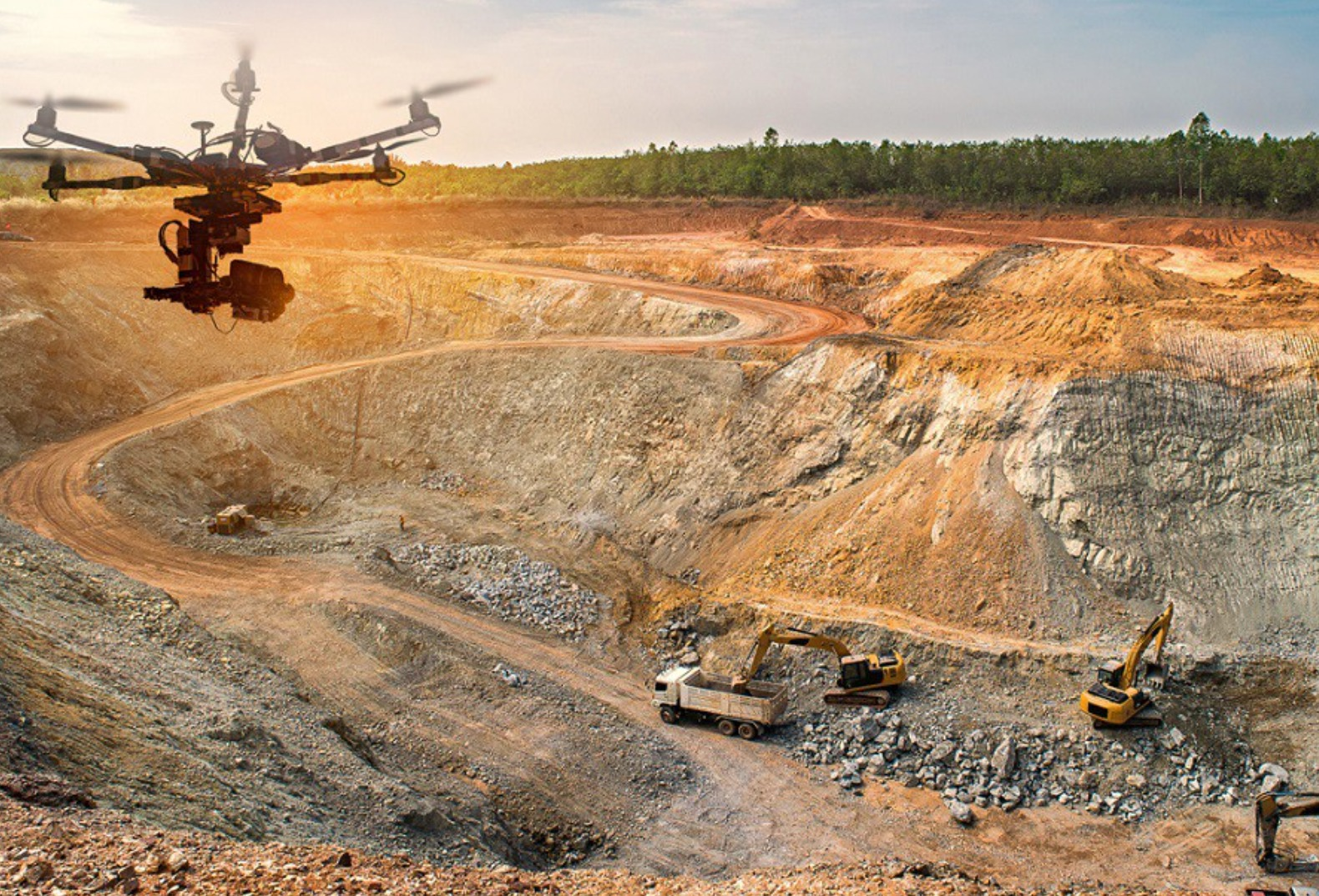
Mineral Exploration Uses
Drones shine in mineral hunts. Specialized sensors detect deposits. They analyze soil makeup. They measure magnetic fields. This cuts ground survey needs. It reduces environmental harm. Exploration becomes efficient. It saves time and resources.
Technology Behind Drones for Geological Surveys
High-Resolution Imaging
Clear imaging drives success. Drones carry advanced cameras. They capture fine details. Rock formations stand out. Soil textures are visible. Vegetation patterns emerge. This precision reveals hidden features. It strengthens geological analysis.
LiDAR and Photogrammetry
LiDAR transforms mapping. It uses laser pulses. These measure ground distances. The result is accurate 3D models. Photogrammetry complements it. Overlapping photos build terrain visuals. Both technologies deepen insights. They detail geological structures clearly.
Long-Endurance Batteries
Battery life is critical. It powers long flights. Drones cover wide areas. Frequent recharges slow work. Taixing Shengya Electronic Technology Co., Ltd offers solutions. Their high-energy lithium-ion batteries last long. They ensure reliable performance. Extended missions become feasible.
Challenges and Considerations in Drone-Based Geological Surveys
Regulatory Hurdles
Drones face legal limits. Rules vary by country. Flight zones are restricted. Altitude caps apply. Permits may be needed. Compliance is crucial. Breaking laws brings penalties. Privacy issues arise too. Drones may film private land. Strict laws must be followed. This protects all parties.
Environmental Challenges
Nature tests drones. Strong winds disrupt flights. Heavy rain grounds them. Extreme heat or cold harms systems. Rugged terrains cause issues. Mountains block signals. Dense forests limit movement. Durable drones are needed. They must adapt to conditions. This ensures steady performance.
Data Security and Precision
Data safety is vital. Drones send sensitive info. Wireless networks risk hacks. Encryption protects transmissions. It blocks unauthorized access. Accuracy matters too. High-precision sensors are key. Advanced imaging ensures reliable data. This builds trust in results.
Future Trends in Drone Application for Geology
Battery Innovations
Battery tech shapes drone use. Long-endurance batteries are crucial. They extend flight times. Large areas get covered. Taixing Shengya Electronic Technology Co., Ltd leads here. Their lithium-ion batteries offer long cycles. They prioritize safety. Future designs may be lighter. Higher energy density is likely. This will boost range further.
AI-Driven Analysis
AI revolutionizes data work. It processes huge datasets. It spots patterns fast. It finds anomalies. It flags mineral deposits. Machine learning sharpens predictions. Researchers make quicker calls. AI cuts manual effort. It pairs with drones. This boosts mapping accuracy. It saves time.
Exploring Hazardous Zones
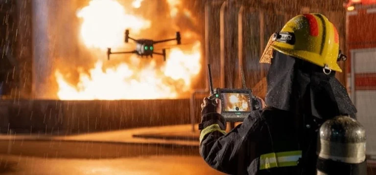
Drones reach tough spots. Remote areas are no issue. Hazardous zones are accessible. Natural disasters don’t stop them. Extreme conditions are manageable. Autonomous drones excel here. They carry special sensors. High-quality cameras aid them. They gather key geological data. Safety stays high.
FAQs
What challenges do drones face in surveys?
Regulations limit operations. Weather and terrain pose risks. Data security is critical.
How do advanced batteries help?
They extend flight time. They boost efficiency. They support large-scale surveys.
Does AI improve mapping?
Yes, it analyzes data fast. It spots trends. It enhances precision.
Are drones good for hazardous areas?
They’re ideal. They operate autonomously. They navigate tough terrains safely.
Contact Taixing Shengya Electronic Technology Co., Ltd for tailored drone battery solutions. Their expertise powers geological surveys!