The Growing Importance of Drone Application in Biodiversity Studies
How Drones Are Changing Biodiversity Research
Unmanned Aerial Vehicles (UAVs), or drones, are reshaping how we study biodiversity. They bring new ways to watch ecosystems. Drones take clear pictures and videos from the sky. This gives a special view of nature’s patterns. Unlike old ground methods, drones move fast over big areas. They are key for exploring large or far-off places. Their precision helps scientists. They look at habitats, species locations, and changes in nature with great detail.
Benefits of Drones in Environmental Work
Drones have big advantages over old methods. They save money. They use fewer resources than planes or big field crews. Drones can go to risky or tough spots. Think of thick forests or steep hills. They gather data without hurting the environment. This keeps nature safe. New drone tools include sensors. These check temperature, moisture, or chemical levels. Such tools make environmental studies richer.
Main Uses of Drones for Plants and Animals
Drones help study plants and animals in many ways. They map out plant cover. They check plant health with special imaging. For animals, drones watch groups, track their paths, or study behaviors. They do this without bothering them. These tools are vital for protecting rare species. Watching without disturbing is very important.
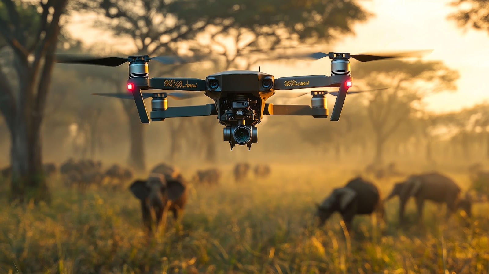
Utilizing Drone Application for Wildlife Monitoring
Following Animal Movements Accurately
Drones with GPS and heat-sensing cameras change how we track wildlife. They give exact details on where animals are. They show their movements too. Scientists can study migration routes. They see territory habits or how animals hunt in real time. Drones cut the need for tags on animals. This reduces human impact. It also keeps data true.
Watching Seasonal and Location Shifts
Drones track seasonal migrations well. They also spot location changes from climate shifts. Clear aerial photos show habitat changes over time. Researchers learn how species adjust. This helps make plans to protect biodiversity from environmental changes.
Watching Wildlife Without Disturbing
Old ways to watch wildlife often need humans nearby. This can scare animals. It changes how they act naturally. Drones are different. They record clear footage from far away. This works great for shy or delicate species that are hard to see up close.
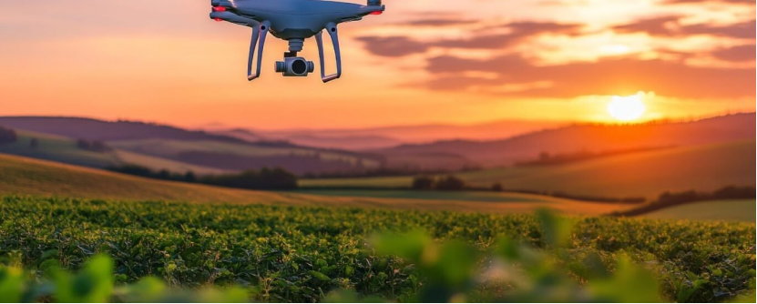
Drone Application in Vegetation and Ecosystem Analysis
Mapping Plant Patterns with UAVs
Unmanned Aerial Vehicles help map plant patterns across landscapes. They use tools like LiDAR or multispectral cameras. These make detailed maps. The maps show differences in plant types, density, or health in various areas.
Checking Forest Health Over Time
Forests are key ecosystems. They need regular checks to stay healthy. Drones with sharp cameras spot problems. They see deforestation, tree diseases, or invasive plants. Constant checks catch issues early. This lets conservation steps happen fast.
Studying Biodiversity in Hard-to-Reach Areas
Many biodiversity-rich spots are in remote places. These are tough to reach with old methods. Drones solve this. They fly to these areas without needing big setups or teams. They gather important data on plants and animals in far-off locations.
Enhancing Data Collection Efficiency Through Drone Technology
Gathering Data in Real Time for Better Research
Unmanned Aerial Vehicles (UAVs) have transformed data collection. They work with great speed and accuracy. Drones take sharp images and videos. This gives instant data for careful analysis. Unlike older methods, drones cover wide areas fast. They need less effort. This is crucial for ecosystems that change quickly. Drones use smart GPS tools. These mark data with exact locations. This makes the data trustworthy for deeper study.
Using Advanced Sensors for Deep Insights
Drones now have high-tech sensors. These do more than just take pictures. Multispectral and heat sensors check plant health. They spot temperature changes. They even measure chemicals in the air or soil. Such rich data helps biodiversity research. It shows how ecosystems work and how species interact. For example, multispectral images check plant chlorophyll. This shows if plants are stressed or healthy. LiDAR makes 3D maps of land. These show habitat layouts clearly.
Solving Problems of Old Data Collection
Old data collection has limits. Remote places are hard to get to. Costs can be high. Humans in the field may harm nature. Drones fix these issues. They are cheaper and don’t disturb ecosystems. They fly through tough areas like forests or cliffs. This reaches difficult spots. Drones also keep sensitive ecosystems untouched during studies.
Future Trends in Drone Application for Biodiversity Conservation
Growing Abilities with Swarming Technology
Swarming technology is a major leap for drones in conservation. Many drones work as a team. They cover huge areas quickly. They gather different kinds of data at once. The drones share details instantly. This makes their work smoother. For instance, one drone maps plants. Another tracks animals nearby. This teamwork saves time. It also makes data richer and more complete.
Possibilities of Beyond Visual Line of Sight (BVLOS) Operations
Beyond Visual Line of Sight (BVLOS) operations bring new options. They let drones fly far beyond what an operator can see. This stretches their reach greatly. BVLOS is perfect for big ecosystems. It also tracks migrating species over long paths. With smart communication and self-flying tech, BVLOS collects data non-stop. It needs little human control.
Teamwork Among Researchers, Tech Experts, and Conservationists
The future of drones in conservation relies on teamwork. Researchers, tech experts, and conservationists must join forces. They can build tools for specific conservation needs. Tech experts make drones with custom sensors. These fit what researchers need for certain species or places. Conservationists use these tools in the field. This gets the best results.
Frequently Asked Questions (FAQs)
How do drones help biodiversity research?
Drones take clear images. They reach remote spots quickly and safely. They don’t harm ecosystems.
What sensors do drones use for environmental studies?
Multispectral sensors check plant health. They measure chlorophyll or stress signs well.
Can swarming technology improve drone use?
Yes. Swarming lets many drones work together. They gather data over large areas fast.
What is BVLOS in drone technology?
BVLOS lets drones fly beyond an operator’s view. It extends their range for big monitoring jobs.
For custom UAV solutions, like high-energy density batteries from Taixing Shengya Electronic Technology Co., Ltd., reach out today!